Bike Path (Class 1)

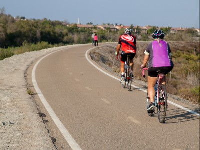
A bike path is non-motorized facility, paved or unpaved, physically separated from motorized vehicular traffic by an open space or barrier. It can also be called a Bike Trail, Non-motorized Trail, Multi-purpose Trail or some combination thereof.

Cyclist riding on bike path

Bike Lane (Class II)

A portion of a roadway that is designated by striping, signing and pavement markings for the preferential or exclusive use of bicyclists. Most often these are done in couplets, each one being one way and adjacent to the outside through travel lane.

Cyclist riding in bike lane in Encinitas, California

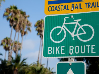
Bike Route (Class III)

A segment of road designated by the jurisdiction having authority, with appropriate directional and informational markers, but without striping, signing and pavement markings for the preferential or exclusive use of bicyclists.

Bike route sign

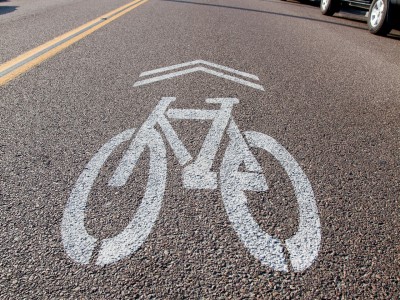
Sharrows

On a roadway or street that is too narrow to implement a bike lane, sharrows are used to designate that cyclists may use the full lane. This allows cyclists to travel safely in the middle of the lane and not be forced to share the lane with cars. Sharing the lane with cars puts the cyclist dangerously close to passing traffic as well as forcing the cyclist to ride in the door zone of parked cars.

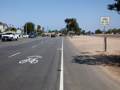
Sharrows are symbols painted in the middle of the right hand travel lane featuring a bike with two chevrons above it. Sharrows should be accompanied by a “BIKES MAY USE FULL LANE” sign along the side of the street or roadway. Cyclists are advised to ride in the middle of the lane where they are can ride outside of the dangerous door zone as well as safely away from traffic passing on the left. In a sharrow zone, motorists are required to treat cyclists like slow moving traffic and merge to the left lane to pass cyclists in the sharrow lane.

As of summer of 2015, sharrows can be found in Encinitas on the 101 in Leucadia, downtown Encinitas and over the train bridge on La Costa. BikeWalk Encinitas is working with traffic officials to get sharrows installed along the 101 between Pipes and restaurant row.

Sharrow on street in Oceanside, California
Sharrow and "Bicycles May Use Full Lane" sign on highway 101 in Leucadia, California

Roundabouts

A modern roundabout is a circular intersection where drivers travel counterclockwise around a center island. There are no traffic signals or stop signs in a modern roundabout. Drivers yield at entry to traffic in the roundabout, then enter the intersection and exit at their desired street. Studies by the Federal Highway Administration have found that roundabouts can increase traffic capacity by 30 percent to 50 percent compared to traditional intersections.

Roundabouts can be intimidating to novice cyclists and to any cyclist who is unfamiliar with them. While they’ve been used in Europe for decades and are gaining popularity around the US, roundabouts are somewhat new to Encinitas.

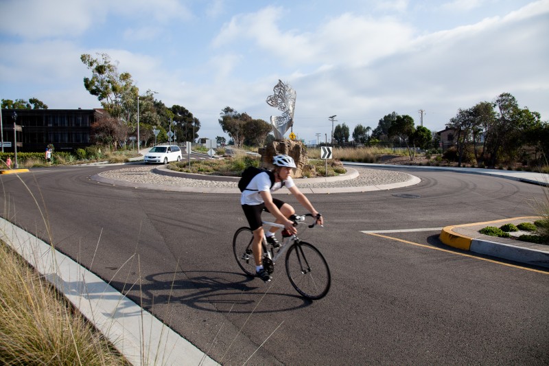
Cyclist riding in roundabout in Carlsbad, California

A cyclist should approach roundabouts just as a motorist does. If you are riding in a bike lane and approaching a roundabout, look over your shoulder to determine if there are cars coming up behind you. Once you’ve confirmed that it is safe to merge into the travel lane, signal your merge and move into the center of the travel lane 50-100’ before the roundabout. At that point you will act just as a motorist. Yield to any traffic coming from the left when entering the roundabout and continue in the middle of the lane until it is time for you to exit at your desired street.

While you do have the same rights as motorists, exercise caution while riding in the roundabout. Motorists, especially those not familiar with roundabouts, can be distracted and focused on other traffic entering and exiting. Distracted motorists can often look right through a cyclist at traffic beyond them.

Roundabouts are located on Santa Fe Dr and Devonshire, Leucadia Blvd and both Hermes and Hymettus Ave. There is also a roundabout on the 101 on the north side of Carlsbad.

Traffic signal detectors

At the head of all lanes at an intersection, there are loop sensors buried in the street. These electromagnetic sensors detect when a car or bicycle is at the intersection and will trigger the traffic signal to turn green.

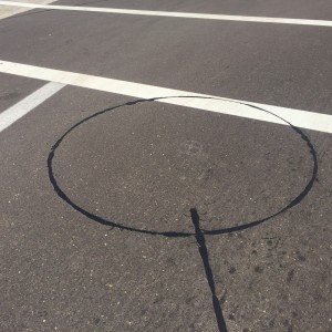
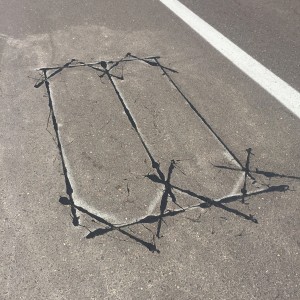
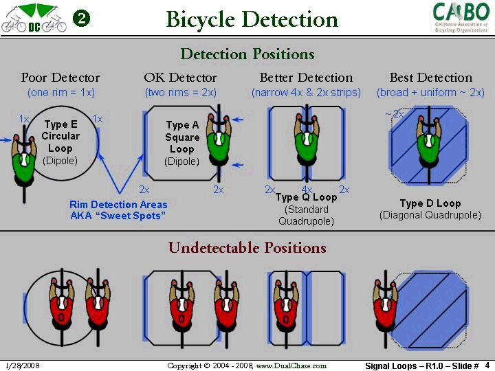
To get the detector to work properly, you need to position your bike over the loop, which unfortunately can be sometimes difficult to see. Many of the loops serve both bikes and motor vehicles. These are commonly circles with a diagonal line running through them.  For this style place you bike across the diagonal line at a 45 degree angle. If it is just a circle…with no diagonal…place your bike across the edge of the loop. See diagram below.

Type E circular traffic signal detector
Type Q Loop Square Quadrupole traffic signal detector
Traffic signal detector position diagram CABO

While these sensors should be set to detect both cars and bicycles, sometimes the sensitivity is not set to detect bicycles. If you come across a sensor that doesn’t detect a bicycle, you can notify the Encinitas city traffic dept. They can then adjust it.

HAWK Crosswalk

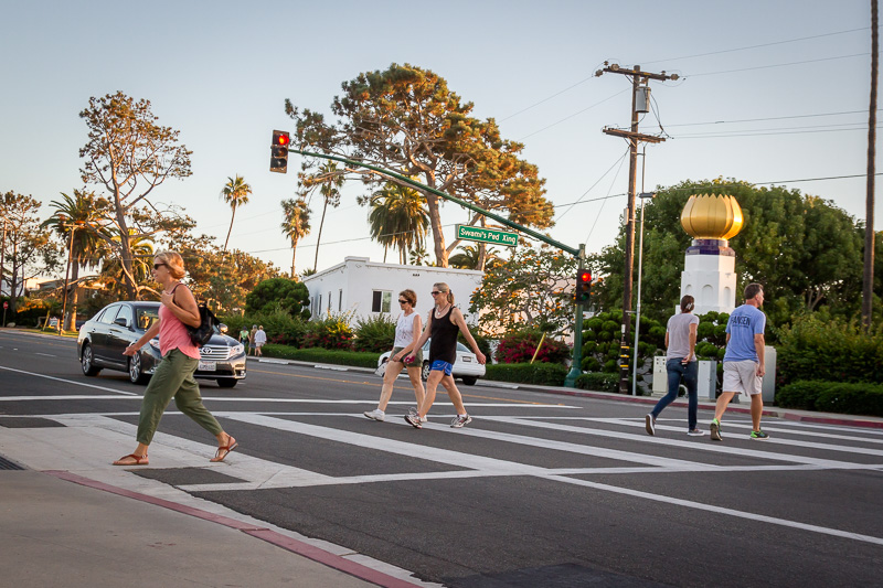
A HAWK beacon (High-Intensity Activated crossWalK beacon) is a traffic control device used to stop road traffic and allow pedestrians to cross safely. It is officially known as a Pedestrian Hybrid Beacon (PHB). The purpose of a HAWK beacon is to allow protected pedestrian crossings, stopping road traffic only as needed. Where standard traffic signal ‘warrants’ prevent the installation of standard three-color traffic signals, the HAWK beacon provides an alternative.

People walking in HAWK crosswalk in Encinitas, California